Excursion to Jordan

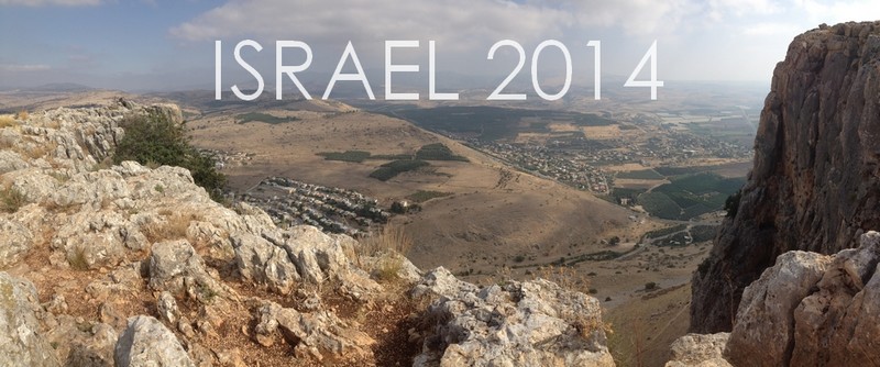
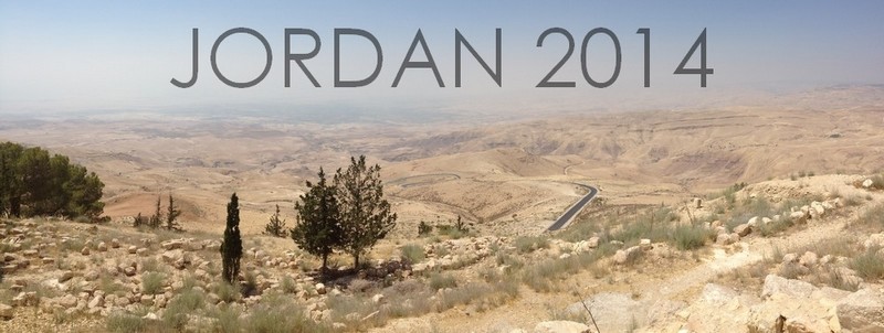
Upon the completion of our three week study in Israel, a number of us remained with JUC for a few extra days to go on an excursion to Jordan. Although I wasn’t required to write a report for the school, I thought it would be fitting to share my experience here on the blog. I’m condensing the entire trip into one post, but I’ve tried my best to be thorough!

DAY ONE: JERASH, JABBOK RIVER, DIBON, ARNON CANYON

Our journey to Jordan began early on Saturday morning with a long bus ride to the customs checkpoint along the Jordan River. After sending my personal effects through a couple of x-ray machines and receiving a ‘how do you do’ from a particularly handsy security guard, my passport was stamped and I was welcomed into the Hashemite Kingdom of Jordan.

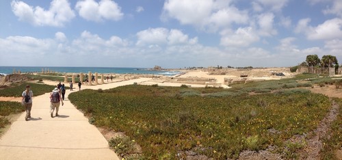
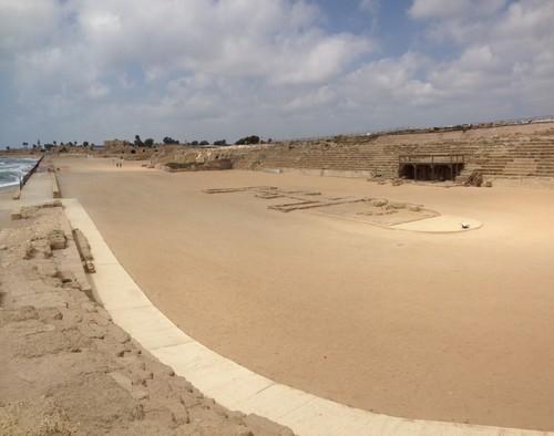
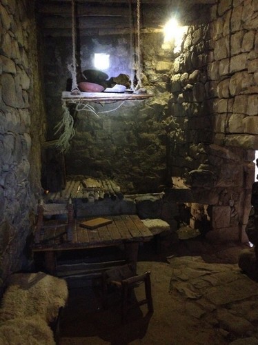
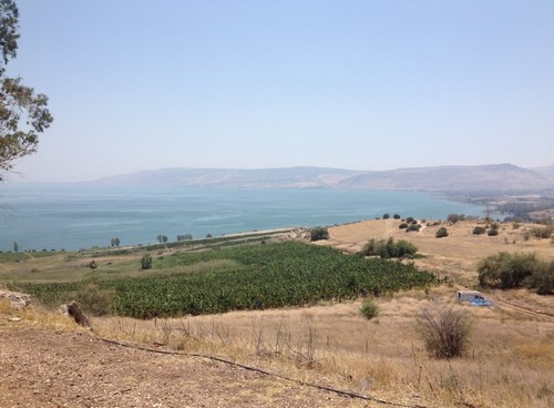
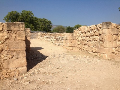
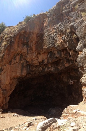
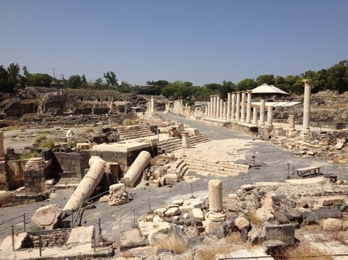
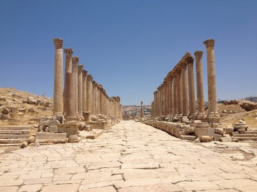
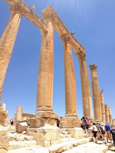
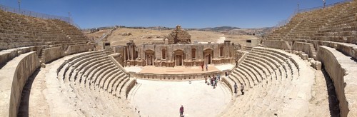
Our first stop was at Jerash, or Gerasa, a Decapolis city. Some believe that Jerash is the city called Gergesa in the Bible (where the ‘swine miracle’ took place), but seeing how far it is from the Sea of Galilee makes it somewhat doubtful. I tend to agree with our instructor, who believes that Gergesa is modern-day Kursi.

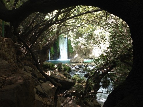
Jerash has been impeccably preserved and restored, offering plenty of fodder for picture-taking:

An arch of Hadrian marked the entrance to the city
Walking down the cardo
Looking down the cardo
The pillars were ridiculously tall - I got a little nervous when our guide showed us that you can rock some of them back and forth
The pillars were ridiculously tall – I got a little nervous when our guide showed us that you can rock some of them back and forth

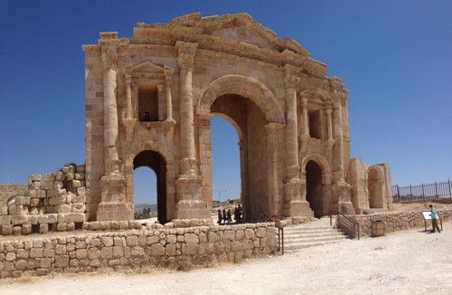
One of my favorite moments at this stop was when we visited the amphitheater. To demonstrate the acoustics of the building, our tour guide asked me to sing for my classmates. I sang the first verse of ‘Come Thou Fount of Every Blessing,’ and sure enough, the sound echoed throughout the seats. It’s not every day that you get a chance to sing a Christian hymn at the site of ancient Roman ruins in a predominantly Muslim region!

The large amphiteater in Jerash

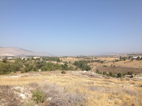
Our next stop was at an overlook of the Jabbok River, where Jacob wrestled with God. Throughout our course we learned about how, in the Bible, whenever someone crosses a body of water, it often symbolizes change. Whether it’s the Red Sea, the Jordan River, or here at Jabbok, some kind of transformation takes place. This is something that I didn’t pick up on before, so now I’m interested in learning more and exploring its parallels with Baptism.

The Jabbok
The Jabbok

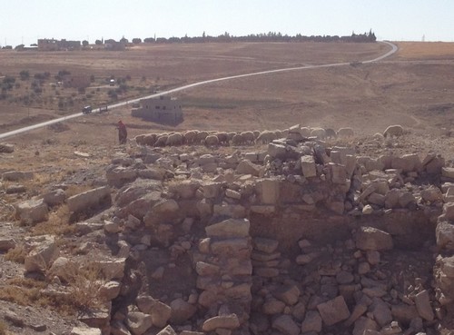
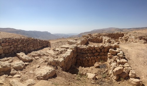
We then traveled to Dibon, where we learned about Israel’s relation to the Moab. Our instructor told us about the discovery of the Mesha Stele and how it informs our understanding of Israel’s conflicts with the Moabites.

A shepherd tending his sheep amongst the ruins at Dibon

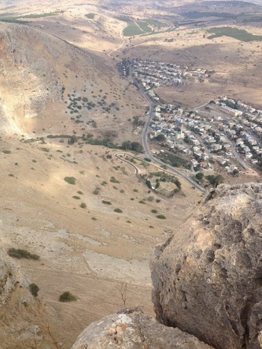
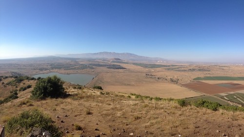
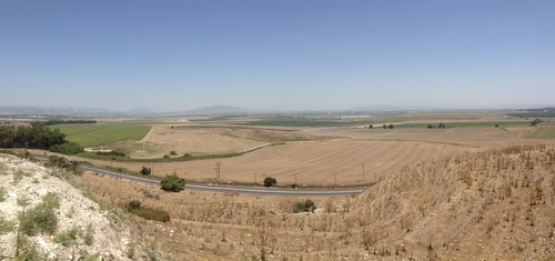
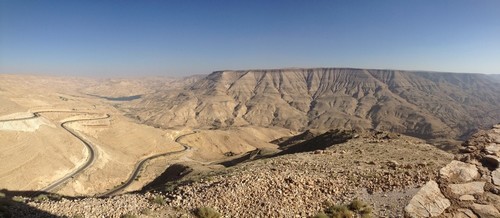
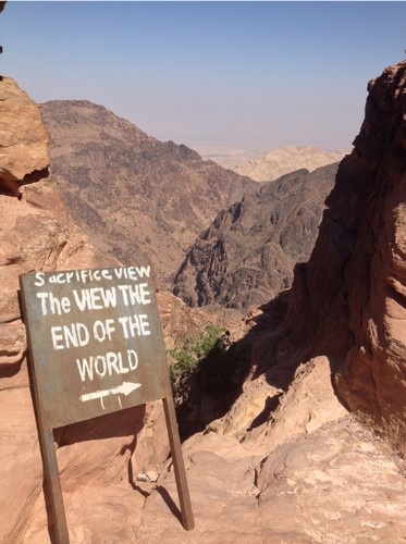
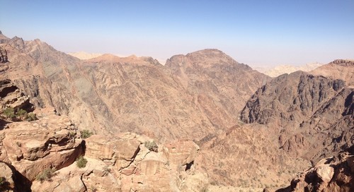
Our final stop of the day before heading down to Petra was the Arnon Canyon. The Arnon served as a boundary line for various tribes throughout the Bible (Moabites, Amorites, Reuben, Gad, etc.). More than anything, this stop provided yet another breathtaking view of the land of the Bible.

The Arnon canyon
The Arnon Canyon

DAY TWO: PETRA, DANA WADI, BOZRAH

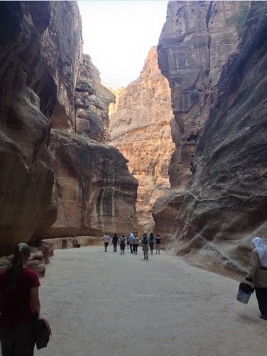
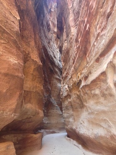
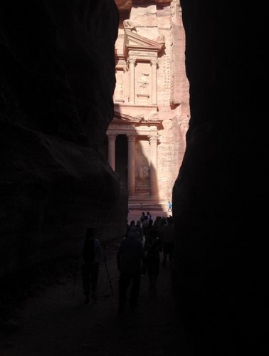
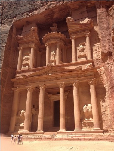
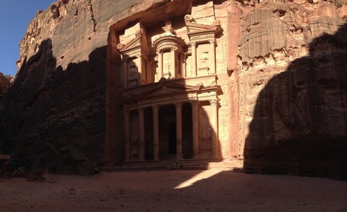
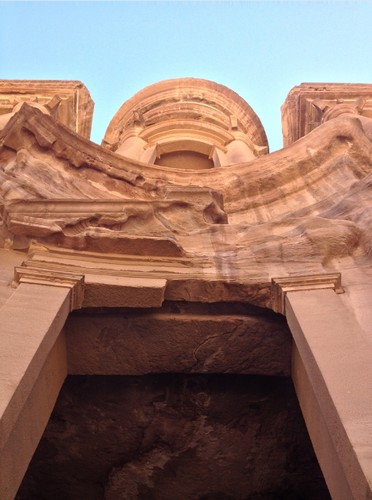
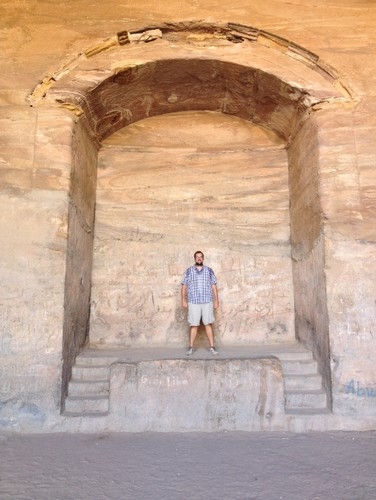
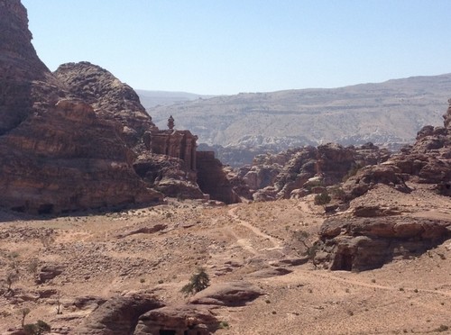
I won’t lie: day two of our trip is the reason I signed up for the extra excursion. I’m a huge Indiana Jones fan, so being able to visit Petra was a dream come true. Petra itself has little relevance to the Bible, except that it belonged to the Nabateans. Here, I behaved far more like a tourist than a student, taking few notes but many photos.

Entering the Siq (the deep canyon entrance to Petra)
It’s starting to look a little Indiana Jones-ish…
Our first look at the Treasury – just like the movie
Massive.
A wide shot of the Treasury

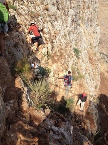
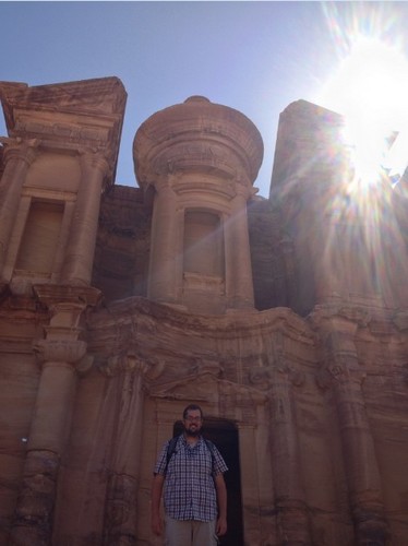
At one point, we hiked up 850 steps to Petra’s highest point, the site of ‘The Monastery.’ The only negative side of walking up all those steps is that we had to walk back down them later! This was by far the most strenuous hike we went on for the entire trip, but it was so worth it.

Above: The Monastery. Below: Sweat Stains
Took this photo from below to try to show y’all how tall this thing really is
Standing on the altar inside the Monastery
Climbing up to the highest point
Standing inches away from the edge – our instructor’s only rule for this outing was “don’t die”
Looking back at the Monastery

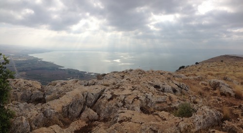
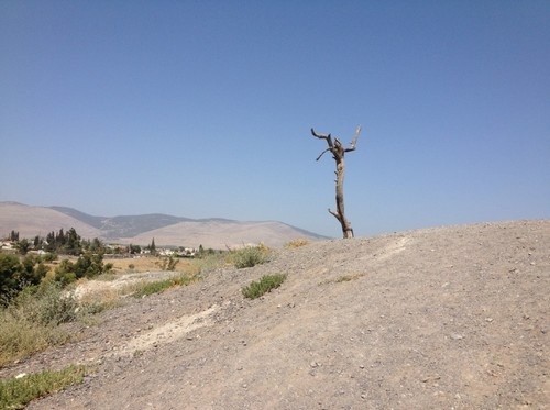
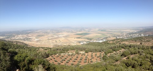
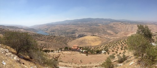
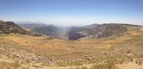
On our way to Bozrah, we stopped by another scenic outlook, this time near the Dana Wadi. It gave us a spectacular view of the land from which we just came.

The Dana Wadi (pronounced "Donna")
The Dana Wadi (pronounced “Donna”)

When we arrived at Bozrah, we learned about Edom and its relation to Israel like we did the day before with Moab. We learned that many of the biblical prophets (e.g. Jeremiah, Amos, Obadiah) had a low view of the Moabites. They were a people marked by violence, rebellion, and disregard for the one true God – which ultimately became their downfall. It truly is interesting to see how Israel has persevered throughout the ages when so many of their contemporaries fell by the wayside. The only thing that differentiated them from the people around them is that they were called out by God.

The ruins at Bozrah
The ruins at Bozrah

DAY THREE: AMMAN, MADABA, MT NEBO

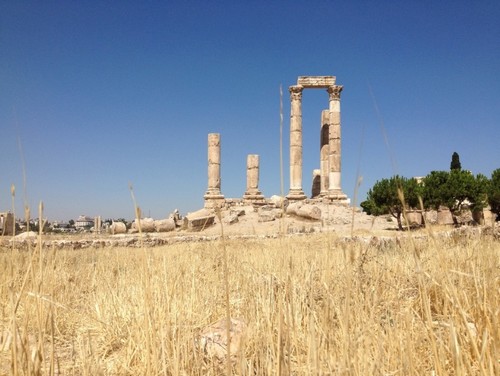
The first location we visited on our final day was Amman, referred to as Rabbat Ammon in the Bible. It was here that Uriah was killed in battle after David’s affair with Bathsheba. We learned about how the city lies on a ‘tongue’ of senonian chalk between areas with greater resources (Upper Gilead to the north and Medeba to the south). Because the Ammonites didn’t have much, they had to be combative to get by – as such, they are portrayed as being particularly aggressive in the Bible.

This architecture isn't from the Biblical era, but it's one of my favorite photos from Amman
Pillars at Amman

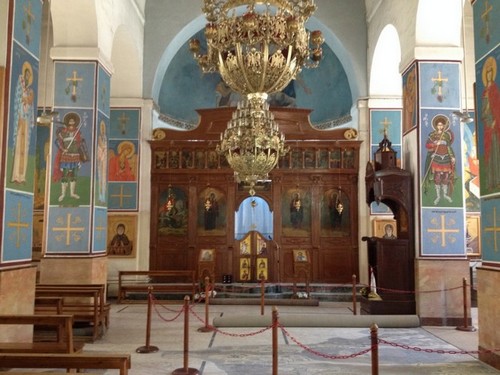
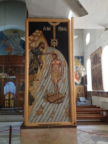
We then traveled to Saint George’s Greek Orthodox Church in Madaba to see the Madaba Map. The Madaba Map is a 1400 year old floor mosaic depicting the Holy Land, showing Jerusalem in great detail.

A large section of the mosaic showing various locations in Israel
Close-up view of Jerusalem

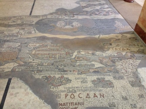
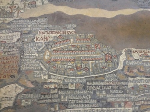
The archaeological and historical significance of the map is obvious – it portrays sections of Jerusalem that have been confirmed since its discovery – but the church in which it resides contains equally beautiful works of art.

church
Icons everywhere – and all mosaics
jesus
The baptism of Jesus, rife with symbolic imagery

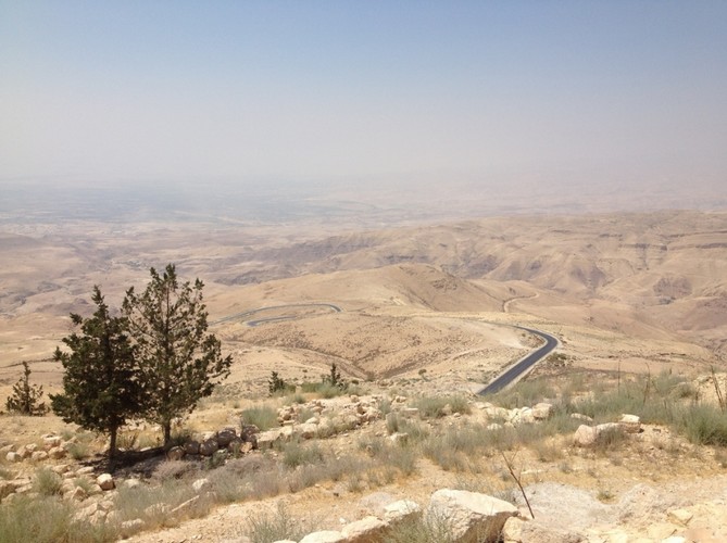
The final stop of our adventure was Mt Nebo:

Then Moses climbed Mount Nebo from the plains of Moab to the top of Pisgah, across from Jericho. There the Lord showed him the whole land—from Gilead to Dan, all of Naphtali, the territory of Ephraim and Manasseh, all the land of Judah as far as the Mediterranean Sea, the Negev and the whole region from the Valley of Jericho, the City of Palms, as far as Zoar. Then the Lord said to him, “This is the land I promised on oath to Abraham, Isaac and Jacob when I said, ‘I will give it to your descendants.’ I have let you see it with your eyes, but you will not cross over into it.” – Deuteronomy 34:1-4

I confess that I didn’t have many emotional moments during my time in Israel, but something about looking over the land that God promised his people got to me. In heading back to Jerusalem, I was about to cross over and enter the land that Moses’ feet never touched.

Viewing the Promised Land from Mt. Nebo
Viewing the Promised Land from atop Mt. Nebo

The fact that I’m even here is unbelievable. I know I’ve said this many times before, but I truly cannot say it enough: I am so grateful for the generosity, kindness, and support of the people who sent me to Israel and Jordan. Thank you so much to the donors, Sioux Falls Seminary, Jerusalem University College, Community Covenant Church, my friends, and of course my family! I do not take this experience for granted, and I pray that I will put it to good use in furthering God’s kingdom.

Amen. I’m ready to come home!

Israel 13 – Legs, Lungs, and Heart

Our final day began at the Cliffs of Arbel. Arbel is most famously known as the place where Herod the Great flushed out dissidents who were hiding in caves along the cliff faces by lowering soldiers in baskets from the top. Our instructor brought us up there, though, to help us process everything we’ve been learning over the last several days.

It was fairly steep
It was fairly steep

As our instructor told us time and time again, the Sea of Galilee functioned as a ‘microcosm of the nations.’ Because the lake is situated in a high-traffic area (several routes to Damascus pass through the region), people of various nationalities, religions, and political affiliations were forced to interact with each other. Jesus spoke of preaching the Good News to all nations, and from this vantage point they would have been able to see all three political districts that surround the lake. It’s not a stretch to assume that, at one point, Jesus probably took his disciples up there to teach them the same kinds of things we’ve been learning.

You can see the 'whole world' from here
You can see the ‘whole world’ from here

Because Galilee was known to be a bustling, metropolitan area, our instructor encouraged us to reconsider our assumptions about what it means that Jesus would occasionally ‘retreat to Galilee.’ More often than not, Jesus is depicted as one who would sneak away to be by himself. While it’s certainly safe to assume that Jesus did this from time to time, references to Galilee should not be interpreted as ‘solitudinal.’ It’s likely that just the opposite was happening – Jesus was leaving Jerusalem to mingle amongst the nations!

When our lecture was over, we hiked down the side of one of the cliffs. Some parts of the descent were fairly precarious, but we all made it down safely. The hike helped solidify just how dangerous it must have been for Herod’s soldiers doing battle here; we were shaking in our boots, even with handrails and a clear path before us.

Don't worry, mom - you can't see it very well, but there were handles to hold on to
Don’t worry, mom – you can’t see it very well, but there were handles to hold on to

Our last stop was Caesarea, perched upon the coast of the Mediterranean Sea. Here, we caught one last glimpse into the world of Herod the Great. Herod built his own mini Roman kingdom at Caesarea, complete with a man-made port to force affluence and trade in his direction. After visiting Herodium, Masada, and Caesarea, it’s clear that Herod was obsessed with ‘defying God,’ as our instructor would put it.

Caesarea
Caesarea
The Hippodrome
The Hippodrome

Our instructor explained that in Acts 1, when Jesus spoke of the “ends of the earth,” most Jews would be thinking of the Mediterranean. It was intriguing to consider how they would have heard those words – they knew that Greece and Rome lie beyond the sea, but for so long Jews understood the Medirranean Sea as the furthest extent of creation. Along those same lines, I think it’s important for Christians today to consider what the ‘ends of the earth’ might be for us. Could the Gospel extend beyond the boundaries within which we think it exists? Certainly something to consider.

Standing at the edge of the sea - I would have gotten closer, but I don't own adventure shoes
Standing at the edge of the sea – I would have gotten closer, but I wasn’t wearing adventure shoes

Aside from our test the next day, our visit to Caesarea marked the end of our studies. I am truly grateful for the opportunity to learn by ‘feeling the Bible in my legs, lungs, and heart’ over the last three weeks. Thank you to everyone who has read these entries and prayed for me!

manmade

Check back soon…I intend to write one more entry for the time we spent in Jordan 🙂

Israel 12 – Sailing the Sea of Galilee

Today we started things off with a boat ride on the Sea of Galilee. In the middle of the lake, the sailors shut the boat’s motor off and we held our lecture there. Our instructor pointed out the regions of Galilee, Gaulanitis, and the Decapolis. This was very effective in helping me grasp what I’ve been looking at on the map. Plus, just being on the boat itself was awesome.

ourboat
Our boat, just before boarding

We then learned about the types of fishing that were common in Jesus’ day. Knowing some basic fishing techniques has put a little more “flesh on the bones” of the story of Jesus recruiting his first disciples in Luke 5:1-11. The fishermen had been working all night using a net that the fish would be able to see during the day. When Jesus told them to cast the net once more it was now daytime, so they were likely skeptical about catching anything at all. The fact that they not only caught fish, but caught many fish makes what Jesus did even more spectacular.

We also learned about how storms are caused on the lake. There are several valleys that lead into the area from the west, funneling and intensifying storms as they blow in from the Mediterranean Sea. Storms here can create waves up to 4-6 feet in height, which were more than enough to damage and capsize a meager first century fishing boat. Our instructor told us that even in the last 20-30 years, there have been cases of fishermen who disappeared on the lake during a storm. This reshaped my view of the disciples’ reaction to the bad weather in Luke 8:22-25 – considering the fact that a good number of them were fishermen, their fear no longer seems that unreasonable!

On that same note, a theme that we’ve discussed over the last three weeks is how the sea (generally speaking) fits into the Jewish worldview. More often than not, the waters are seen as chaotic, uncontrollable, and dangerous. Only God has power over the sea. Knowing this, the disciples’ reaction to Jesus takes on greater significance: when they asked, “Who is this? He commands even the winds and the water, and they obey him,” they were really asking “Who is this man, who does what only God can do?”

Lecture on the lake
Lecture on the lake

Once we were off the boat, we traveled up the eastern shore of the lake to Kursi, or Genasaret. Kursi is one of the three possible sites for where Jesus cast demons out of a man into a herd of pigs. Due to the fact that the scriptures say it was across the way from Galilee and in the Decapolis, our instructor believes that Kursi is the most probable site, both geographically and culturally. Here, we were encouraged to put ourselves in the shoes of the demon-possessed man, his family, and the community at large. Traveling to these places and experiencing them firsthand is making it easier to do so. These were real people, not just characters in a story. I hope to bring that mindset home with me.

'...the whole herd rushed down the steep bank into the lake and died in the water.' - Matt 8:32
‘When the demons came out of the man, they went into the pigs, and the herd rushed down the steep bank into the lake and was drowned.’ – Luke 8:33

Our next stop was Qatzrin, which offered us a window into first century Jewish life. We saw a wine press, two variations of an olive press, and a typical Jewish home. Learning about first century life in particular helped me better understand various passages of scripture. For instance, the parable of the lost coin is more meaningful to me after seeing the cracks and crevices in the kind of floor Jesus was talking about. Or the story of the paralytic being lowered from the roof – now I’ve seen that kind of roof. Jesus’ statement about preparing a room for his disciples also means more knowing that Joseph was likely more than just a carpenter, but also an engineer or home builder. So many things that appear in scripture are foreign to a twenty-first century American, but they were commonplace to those with whom Jesus interacted! It’s important for us to try to place ourselves in their shoes to understand what Jesus was talking about.

A typical Jewish home

Next, we visited the Mount of Beatitudes, one of the possible locations for where Jesus preached his famous Sermon on the Mount. From where we were standing, our instructor pointed out Magdala and Hippos at different points on the lake. Magdala is a city where they salted fish, and Hippos was a city perched upon a high plateau – a city on a hill. Again, Jesus was employing accessible metaphors for his listeners.

The Mount of Beatitudes

After a quick hike down the hill, we found ourselves at the Church of the Primacy of Peter. People believe it was here that Jesus restored and commissioned Peter after Jesus’ resurrection.

Just off the shore from the Primacy of Peter

We completed our day’s journey at Capernaum, which lies on the border between Galilee and Gaulanitis. There is a church there that was built over the remains of first century architecture believed by some to be the home of Peter.

The church here looked pretty wonky, so here's a photo of a cool statue of Peter instead
The church here looked pretty wonky, so here’s a photo of a cool statue of Peter instead

Here, our instructor used the border between Galilee and Gaulanitis as a tool to help us understand the international nature of the area, and even the competing viewpoints and politics amongst the 12 disciples. Even though Jesus’ inner circle was comprised of Jews, there were tax collectors, zealots, Hellenists, and other allegiances represented within the group. They were, on a small level, a preview of what Jesus wants to do with the world. The love of God brings people together, paying no mind to what divides them.

Israel 11 – The Gates of Hades

Today we traveled north of the Sea of Galilee. Our first stop was Hazor, the largest city in ancient Israel. We spent some time studying Joshua‘s conquest there to help us get a handle on the major cities and routes of the area. Unfortunately, the geography is still a little fuzzy for me…I’m probably going to have to spend some quality time with my maps before Friday’s test!

The Solomonic Gate at Hazor
Cracks in the basalt stonework at Hazor lend credibility to the Biblical account of Joshua's conquest found in Joshua 11
Cracks from fire in the basalt stonework lend credibility to the biblical account of Joshua’s conquest of Hazor found in Joshua 11

Then we went to Tel Dan. Our arrival at Dan was somewhat of a culmination – over the last two and a half weeks, we’ve traveled along the full extent of the Patriarchal Highway! Here, we looked at a 3,800 year old Canaanite city gate before moving on to the Israelite city. We hiked alongside the Spring of Dan, the largest spring in the Middle East and one of the headwaters of the Jordan River. When we arrived at the outer gate of the, our instructor led a talk over the subject of judging and Israelite law. I found this discussion to be particularly revelatory, as it helped me achieve a better understanding of the social structure and justice system of ancient Israel.

These mud bricks have been standing for nearly 4,000 years

Our next stop was Cesarea Philippi, where Peter made his confession that Jesus is the Son of God. Our lecture took place at the mouth of a cave that used to be the source of the Spring of Banias, another headwater of the Jordan River (the spring is still there, but it no longer runs through the cave like it did in Jesus’ time). Our instructor explained that from early on, the cave was a cultic site dedicated to worshipping the Greek god Pan. Later on under Roman rule, it was associated with Hades. Our instructor suggested that maybe it wasn’t a coincidence that Jesus chose to speak of the ‘gates of Hades’ here! Once again, our study of the land was revealing something new about the Scriptures.

The Cave of Pan
The Cave of Pan
Waterfalls downstream from the spring

Our last stop was Mt. Bental, which gave us a great view of Mt. Hermon and the farthest we could travel towards Damascus before entering Syria.

Mount Hermon
Mount Hermon

There on the border, our instructor turned to Isaiah 19:23-25:

In that day there will be a highway from Egypt to Assyria. The Assyrians will go to Egypt and the Egyptians to Assyria. The Egyptians and Assyrians will worship together. In that day Israel will be the third, along with Egypt and Assyria, a blessing on the earth. The Lord Almighty will bless them, saying, “Blessed be Egypt my people, Assyria my handiwork, and Israel my inheritance.”

This is yet another example of a scripture that has been brought to life for me during our time in Israel. While it’s certainly possible to understand this passage without ever coming here, the promise becomes palpable when you have firsthand experience. It may no longer be the empires of Egypt and Assyria putting the squeeze on Israel, but it doesn’t seem like too much of a stretch when you have to look beyond a large security fence to see the other side of the valley. I am praying for the day we see these words come true.

Israel 10 – On the Way to Galilee

This morning, we embarked on our four day excursion into Galilee. Our first stop of the day was at Beth Shean, a tel to the west of Mt. Gilboa and southwest of Mt. Moreh. Beth Shean is the city where the Philistines hung Saul‘s body outside its walls after he took his life during battle.

bethshean
The view from Beth Shean

Our class discussed the circumstances surrounding Saul’s death, such as why he was in the area fighting the Philistines to begin with: Saul was working to unite the kingdom, and the Philistines were threatened by the northern tribes coming together. As long as they remained isolated from each other they weren’t a threat to anyone, but Israel’s unification meant trouble for those in the more international region to the north. Our instructor pointed out that Saul was actually doing the right thing as king by working towards unification, challenging the caricature of Saul that’s become ingrained in the western Christian psyche. “He didn’t always act crazy,” he reminded us.

I took this photo for my dad - the tree where Judas hanged himself in Jesus Christ Superstar
I took this photo for my dad – the tree where Judas hanged himself in Jesus Christ Superstar

Also at the site of Beth Shean was the Second Temple era city of Scythopolis. Its architecture, its temples, and its theater painted a strikingly different picture than we’ve become accustomed to at the Israelite locations. As we sat on a hill above the city, our instructor invited us to take in the spectacular view and consider the wealth and power of the Decapolis cities. Their grand qualities were used as “evangelism tools” for Rome – it’s no wonder that groups like the Sadducees were willing to play along.

Roman ruins
Roman ruins
Spending time at the public restroom in Scythopolis

The next place we visited was Megiddo, which gave us an excellent overview of the Jezeeel Valley. From the top of the tel we could clearly see the Nazareth Ridge, Mt Tabor, the Tabor pass, Mt. Moreh, the Harod pass, Mt. Gilboa, and the Megiddo pass. In the foreground lie the Jezreel Valley and the Kishon Wadi. With the valley as his backdrop, our instructor walked us through the stories of Deborah and Jael, and Josiah’s fall in battle. We also discussed various views concerning the references to Megiddo found in Revelation.

The view from Megiddo

The next site we visited was Mt. Carmel, where Elijah challenged the prophets of Baal. At this stop, our instructor shared his interpretation of the events that transpired there, helping us understand the cultural and religious backdrop of Elijah’s story. As we surveyed the land from the top of a scenic outlook, we could see Nazareth in the distance, which is where we traveled next.

Looking off the top of Mt. Carmel

Our location along the Nazareth ridge offered yet another breathtaking view of the Jezreel valley. As we looked southward, we could see Mt Tabor to our left and, across the valley, Mt Moreh directly in front of us. Here, our instructor asked us to consider all of the biblical events that occurred in the vicinity of Jesus’ upbringing (e.g. Deborah and Jael, Elisha raising a young boy from the dead, Saul’s defeat, etc.). Jesus grew up in Israel’s heartland, so to speak. But he also grew up in a poor area under Roman control; anyone hearing these stories would have looked back on them as the “good old days,” longing for God to restore Israel to its former glory.

On the edge of the Nazareth Ridge

Our instructor explained that this is the proper context for Luke 4:14-30 when Jesus traveled to Nazareth and read from Isaiah in the local synagogue. At first, his proclamation was well received, which is something I had never noticed in my reading before. I don’t know if it’s because I’ve become so familiar with rote recitations of the story, but in my mind I always understood that Jesus read from the scroll and everyone became upset about his claim to have fulfilled the prophecy. But a closer look at the text reveals that the people in the synagogue became upset only when Jesus implied that God’s promises were not only for his chosen people, but also for the Gentiles. Jesus was turning their expectations and worldview on its head. Jews in Jesus’ day wanted God to send his Messiah to overthrow the Romans, not invite them in!

Interestingly, the site where we studied this passage is understood to be the spot where they attempted to throw Jesus off a cliff. While there is absolutely no basis for it in scripture, local tradition states that they actually did throw him off the cliff, but he flew away. Gotta love local legends.

Driving into Galilee

After spending a lot of time in the Old Testament, it’s been awesome bringing Jesus back into the picture a little. Even though this class is only three weeks long, I believe I’m gaining knowledge that can inform and apply to so much of what I’m already doing. I know I’m starting to sound like a broken record at this point, but I can’t wait to get home and start putting what I’m learning here to good use!