Israel 7 – The Negev

Today we explored the biblical Negev and the greater Negev, discussing topics such as prescribed versus practical religion; Abraham’s way of life; and the the influence the Nabateans had over trade in the south.

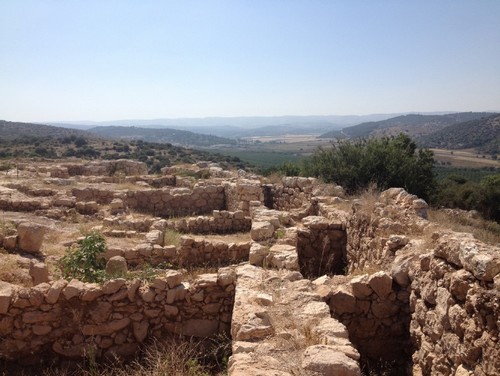
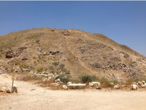
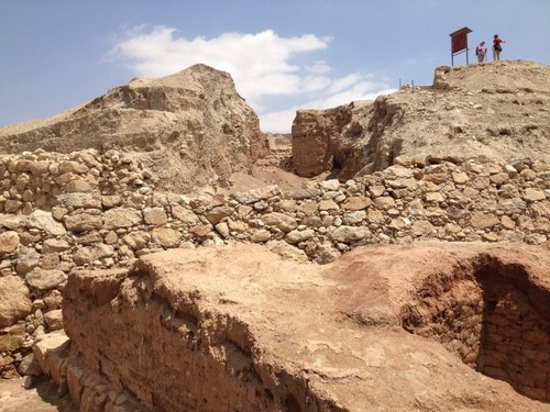
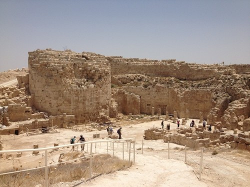
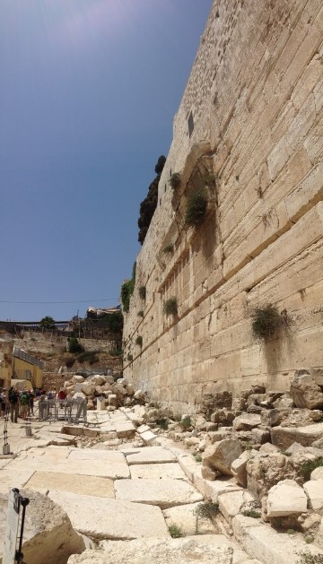
Our first stop was Tel Arad, the site of the biblical city of Arad. We learned of its strategic position tucked away under the southernmost portion of the Judean hills, overlooking the spice route. It also lies on what our instructor called an Eocene ‘hiccup’ in the Senonian rock that surrounds it, producing natural cisterns in an otherwise barren area. A discussion with my parents back home the other day helped put Arad’s annual rainfall into perspective – Omaha has seen a lot of rainfall lately, and apparently, they had 7 inches of rain the other night. Come to find out, that’s about how much rain Arad receives in a year!

Arad from a distance

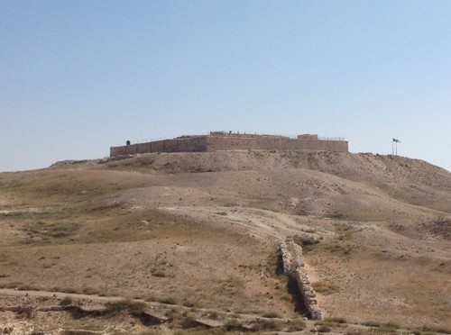
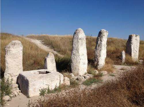
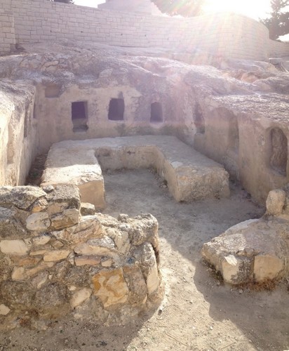
I found the presence of a temple to Yahweh at Tel Arad, complete with an altar and a Holy of Holies, to be quite intriguing. Since Arad was located so far away from Jerusalem, the temple may have functioned like customs, announcing to visitors that they were entering the land of Yahweh. Although scripture is clear that there should only be one House of God, the existence of this temple demonstrates that the state was sanctioning dubious activities like this at the time. What’s more, the Holy of Holies contained multiple incense altars and standing stones, which suggests that they were using the temple to worship not only Yahweh, but other gods (e.g. Asherah). Archaeology shows, however, that by the time of Hezekiah’s reign the temple had been scaled back, and it was finally put out of commission entirely once Josiah assumed the throne.

Not sure if this is sacreligious, but here I am standing in the Holy of Holies

As we walked throughout the site, I had a discussion with a classmate about parallels between practical religion in the time of Judah and our worship of God today. It’s clear that everyone has their own ‘little gods’ that they worship on the side, be it a sports team or a personality or a product, yet I’m still mulling over the possibility that our churches could be sanctioning this type of behavior. It’s easy to point a finger at televangelists or churches that hock the ‘health and wealth’ gospel, but I wonder if those of us in churches who love God and have relatively solid theology have any blind spots. As a pastor myself, I want to remain faithful to God and make sure that I’m not unintentionally misleading the congregation I’ve been called to serve!

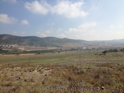
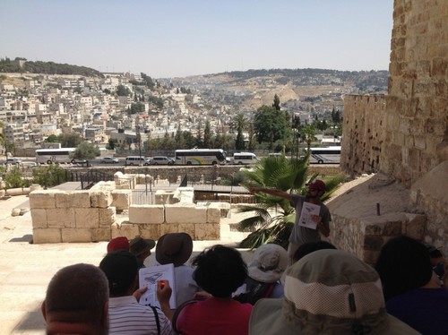
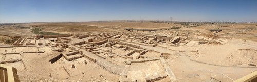
The next site we visited was Tel Beer Sheva, the site where Abraham and Abimelech swore an oath in Genesis 21. Here, we learned about how Beersheba’s location along the Spice Route and the Watershed Ridge Route would have been extremely advantageous for Abraham as he lived, worked, and traded in the area.

Beersheba from above

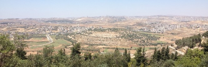
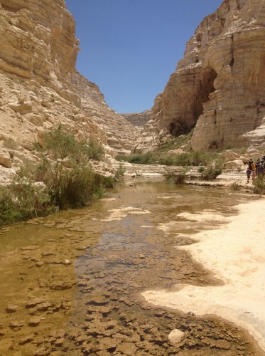
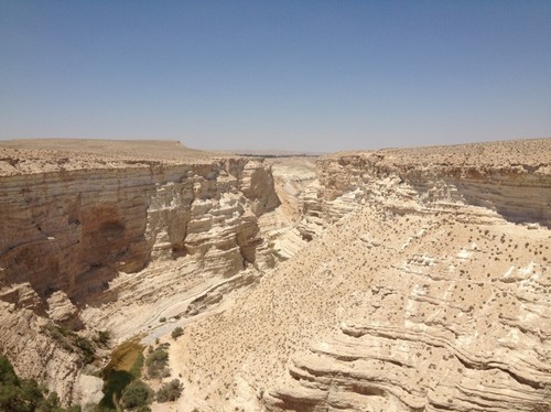
Our next stop was in one of Israel’s national parks for a wilderness hike to ‘experience the Bible in our legs and in our lungs,’ as our instructor says. We started at the bottom of a crevasse and hiked all the way to the top. It was hard work, but so worth it for the view at the end! An opportunistic ice cream salesman had set up shop at the end of the hike, too. He received a lot of business from us that day 🙂

This is roughly where our hike began...
This is roughly where our hike began…
...and this is where it ended!
…and this is where it ended!

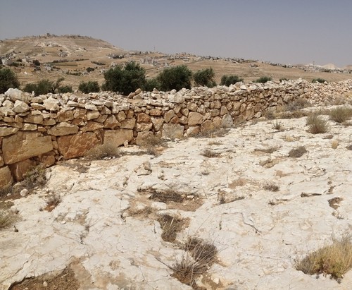
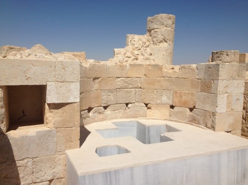
We then traveled to Avdat, a site once inhabited by the Nabateans. The Nabateans were known for trading items like frankincense and myrrh, leading some early church fathers to believe that the Wise Men at Jesus’ birth were of the same people. The Nabateans had come from beyond Edom in Arabia to settle in Avdat and various other places in the area to control trade. They went as far as damming wadis to divert water resources to the places they had settled, forcing travelers to come to them. History suggests that the Nabateans eventually converted to Christianity, which makes the Wise Men connection that much more poetic.

A reconstructed baptismal font at Avdat

Lastly, we visited Makhtesh Ramon and peered over its cliffs. This stop marked the halfway point in our studies, so our instructor gave us some time to sit alone with God and reflect on our journey thus far.

This photo doesn't do Maktesh Ramon justice
This photo doesn’t do Makhtesh Ramon justice

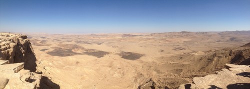
The sight was beautiful, and the time spent in prayer was much appreciated. At this rate, I’m going to be bushed by the end of this trip – but so far it’s been worth every drop of sweat!

Israel 6 – The Shephelah

Today we traveled down the Shephelah, hitting various biblical cities and discussing corresponding narratives along the way. We stopped at Beit Shemesh, Shaaraim, Lachish, and Ashkelon. After learning about the Diagonal Highway in class yesterday, it was helpful to experience the region in person.

At Beit Shemesh, we learned about the historical tug of war over the area. Canaanites, Philistines, and Judahites jockeyed for position there, as it was one of the first major cities coming down from the Judean highlands towards the Coastal Plain. As we stood upon the tel, our instructor pointed out Zorah to the north, the birthplace of Samson. Surprisingly, the story of Samson was highly relevant to learning about tensions between the Philistines and Judahites during Judah’s expansion southward.

Looking towards Zorah from atop Beit Shemesh

Our next stop was Shaaraim, which provided a stunning overlook of the Elah Valley and the surrounding area. We could see Azekah to the west and Socoh off to the southeast. Apparently, Shaaraim may have been fortified as an outlook by David after he flushed the Philistines out of the area. After learning this, one of my classmates pointed out to me that we had just walked through the same entrance gate that David himself used.

Overlooking the Elah Valley from the ruins of Shaaraim

Here, we put ‘flesh on the bones’ of the story of David and Goliath. Learning how the event connects with the land helped me realize the importance of what we’re studying – knowing that this conflict was a pivotal moment in the war between the Philistines and Judah made it ‘real’ for me. This isn’t to suggest that I didn’t believe the story at first; it’s just that, in my mind, it no longer exists as a self-contained, flannel-graph Sunday School lesson. So far, this is what I’m finding most beneficial about our studies: it’s providing helpful context to familiar stories and helping me make connections I hadn’t considered before.

Next, we traveled to Lachish, the last of Judah’s cities along the Diagonal Road. Sennacherib was in Lachish when Hezekiah finally surrendered himself to the Assyrians after they had laid waste to all the other fortified cities of Judah.

Lachish, from below the tel. We walk up a lot of hills in this class...
Lachish, from below the tel. We walk up a lot of hills in this class…

Finally, we made a quick stop at Ashkelon before most of the group jumped in the water at the beach. It was a thriving port under the Philistines and, later, under the Romans as well. Apparently Herod the Great was born there, too. We didn’t stay at Ashkelon for very long, but our instructor used the environment as an opportunity to teach us about the biblical concept of chaos in relation to water.

The shore of the Mediterranean

And that’s all I have to say about that.

Israel 5 – On Jordan’s Muddy Banks I Stand

Today marks the end of an amazing-yet-tiring week. My brain is full of new information, my legs are tired from hiking, my memory is busy cataloguing once in a lifetime experiences, and my heart is grateful.

We started out the day just east of Jerusalem in the Judean Wilderness. The land we observed is referred to as ‘Midbar’ and ‘Yeshimon’ in the Bible. The former word refers specifically to the land we were looking at – the dry, open, but livable land of the Bedouin. The latter word means desolate, solitary, or desert. Both words are translated as ‘wilderness.’

Apple of God's Eye
When I consider having to spend 40 years out here, suddenly the Israelites don’t seem so whiny

I appreciated our instructor’s reminder that when someone is in the ‘wilderness,’ it doesn’t mean they’re any farther away from God! In fact, it’s just the opposite: Deuteronomy 32:10 says, ‘In a desert land he found him, in a barren and howling waste. He shielded him and cared for him; he guarded him as the apple of his eye…’ Our instructor pointed out that the phrase ‘apple of his eye’ is literally translated as ‘little man of the eye.’ He proposed that this passage might be suggesting that God was close enough to see his own reflection in the eyes of his people. In other words, when someone is in the desert they might feel alone, but it’s there that God draws near!

He then asked us to sit and listen to the quiet of the desert for a few moments. In the stillness, one could only hear the sound of distant birds and the wind blowing through the canyons. When everything else is stripped away, it’s just you and God. In the wilderness, God draws near.

We then moved on to follow Joshua’s journeys outlined in the first few chapters of Joshua. Our first stop along this route was at the Jordan River. We discussed Joshua’s crossing, water metaphors, and parallels in Jesus’ life (specifically, his baptism).

Murky.
I’ll be honest…I wouldn’t want to be baptized in this

Our next stop was Jericho, which provided more practical knowledge for understanding Joshua’s military tactics.

The walls of Jericho. Not THE walls of Jericho, but still
Next stop: Jericho! Here are its walls. Not THOSE walls, but still…

Then we went to Nabi Samwil, which was extremely helpful in getting a handle on the land – being able to see several of the sites we’ve been studying on the map from a high vantage point helped solidify their locations in my mind.

I actually knew what I was looking at for once
The view from atop Nabi Samwil

Our final stop was at Gezer, the site of one of King Solomon’s cities as stated in 1 Kings 9:16. There were several standing stones at the site, which could have been boundary markers or altar stones.

Geezer.
The standing stones atop Gezer – one of my favorite sights thus far

While I am immensely grateful for this opportunity and everything I’m learning, I feel like I’m a Bible history ‘lightweight’ compared to my classmates. I’ve never been a history or geography buff, so it’s a little intimidating knowing that I have a test over those subjects on Monday (I plan to study quite a bit tomorrow!). I will say this much, though: the material is being presented in a way that makes me want to learn more. Just today I was telling one of my classmates that when I get home, I’d like to do a read-through of the Bible with a map handy. To use an archaeological metaphor, it’s like I’m beginning to unearth something that has always been just below the surface, but until now I’ve never had the tools to uncover it. Slowly but surely, I hope to improve my skills so that I can reap the full benefits of this experience.

Israel 4 – Overload

Wow…today we did so much that it’s difficult to process. It was our first day out in the field, and we went to nine different sites. Instead of trying to unpack every site in detail, I will attempt to give a quick ‘snapshot’ of each of our stops.

We started out the day on Mt. Scopus, just north of Jerusalem. Our instructor showed us how much easier it would have been for Israel’s enemies to attack from the north rather than the south, stopping to ‘scope out’ Jerusalem from the higher ground we were standing on. We also peered into a first century burial tomb and learned about Jewish burial practices.

A first century Jewish tomb
A first century Jewish family tomb

Our second stop was on the east side of the mountain, looking off into the Judean Wilderness. To the northeast we could see Anathoth, which is where Jeremiah lived. Our instructor explained the differences and variables at play between farming and shepherding life as we peered over the east side of the Mount of Olives range. Jerusalem is situated in a unique topographical area that receives more rain than it should, so just beyond the range is a much more dry and arid area not suitable for farming. Seeing the dusty brown earth sparsely littered with flecks of green challenged my previous perceptions of ‘The Good Shepherd.’ In the past, I would imagine a quiet, lush, serene scene, maybe something you’d see in a Thomas Kinkade painting. Now, I imagine a hard, patient life marked by dirt, wind, and survival.

Not sure if Kinkade ever visited the Holy Land...
Pretty sure Kinkade never visited the Holy Land…

We then went to the Sanctuary of the Dominus Flevit (The Lord Wept) on the Mount of Olives, a Roman Catholic church built on a site commemorating Jesus’ weeping over Jerusalem in Luke 19:41-44. Here we were able to observe some first century ossuaries.

After letting the deceased's body decompose in the tomb for a year, they'd open it back up to retrieve the bones and place them in an ossuary
After letting the deceased’s body decompose in the tomb for a year, they’d open it back up to retrieve the bones and place them in an ossuary

Making our way further down the mountain, we stopped at the traditional site of the Garden of Gethsemane. While we were able to take photos in the garden and spend time in silent reverence at the Church of All Nations, what was most moving for me was our instructor’s take on Jesus’ time spent praying in the garden. He pointed out that, there on the Mount of Olives, Jesus would have been in a prime location to slip away into the wilderness and escape his death. In other words, Jesus had a choice, and his option to flee would have been easy and quick. It made me appreciate all the more Jesus’ choice to give himself up.

Inside the Garden of Gethsemane

Then we drove over to Herodium and learned more about Herod the Great’s life and death. Since we were on a high vantage point and Bethlehem was visible in the distance, our instructor also used it as an opportunity to explain David’s way of life. Herodium was large and impressive, but up there on the height the heat of the day really began to beat down on us. It was at this stop that I finally caved and bought a hat to start shielding my face from the sun!

Herod the Great's love letter to himself
Herod the Great’s love letter to himself

Our next stop was on the way to Bethlehem. We pulled over on the side of the road and walked into a large open area, not realizing that we were standing in the midst of a threshing floor. We learned about the threshing process, and since it seemed appropriate, our instructor helped explain some of the greater context of the story of Ruth and Boaz. While these stories might seem superfluous to some, I very much appreciate how our curriculum integrates theological elements into the discussion. As someone who is a little more conceptual, they serve as tiny ‘shots in the arm’ to keep me going.

A modern threshing floor, only recently put out of use by new technology

Bethlehem, unfortunately, was a drag. We walked up to the Church of the Nativity, which is in constant disrepair. It was almost sickening to see how the political, religious, and economic tensions here have taken a toll on the area. It moves me to pray for God’s intervention, that he would finally bring his peace to the area. Regardless of whether we were at the actual birth place of Jesus or any other venerated site we’ve visited, the juxtaposition of God’s holiness and humankind’s knack for ruining everything is leaving me a little dizzy.

A warehouse. Oh wait, it's the Church of the Nativity
A warehouse. Oh wait, it’s the Church of the Nativity

One of the last sites we visited was a field where we actually saw a shepherd tending his flock in the distance. There, our instructor made his case for reconsidering the circumstances of Jesus’ birth based upon his understanding of first-century homes and culture.

Lastly, we stopped at Ramat Rachel, an archaeological site with no confirmed connection to the Bible. As I understand it, we stopped there primarily to demonstrate that archaeology is more of an art than a science. The puzzle is still coming together, and some questions may go unanswered until the end of time. Sounds kind of like our journey of faith, eh?

Pottery shards from Ramat Rachel
Pottery shards from Ramat Rachel…like tiny puzzle pieces

Israel 3 – Where Jesus Walked

Today we went on the New Testament Jerusalem walk, traveling to Robinson’s Arch, the Southern Wall of the Temple, and the pool of Bethesda.

Robinson’s Arch is located on the southwestern corner of the Temple, named after Edward Robinson, the American archaeologist who discovered it. As we sat in the area that used to be covered by the arch, we learned about Herod the Great’s construction of the Second Temple and his addition of the Court of the Gentiles. It was helpful to be able to pair the images of what we were seeing with familiar stories like Jesus driving out the money changers and Jesus being tempted by the devil to throw himself from the highest point of the temple. It was also awe-inspiring in the general sense – seeing the massive cornerstones at the southwest corner and knowing that the wall used to be even taller than it is now made me gain an appreciation for just how impressive the Temple’s construction really was.

We sat directly beneath the remains of Robinson's Arch. Check out the linked wikipedia entry to see what it used to look like!
The view from directly beneath what remains of Robinson’s Arch

We then walked over to the southern steps of the Temple, a site where Jesus likely would have taught. As we looked out on the City of David, our instructor reminded us of Jesus’ words in Matthew 23:27:

‘Woe to you, scribes and Pharisees, hypocrites! For you are like whitewashed tombs, which outwardly appear beautiful, but within are full of dead people’s bones and all uncleanness.’

Suddenly this analogy was brought to life as we looked across the Kidron Valley at the various tombs and graves lining the Mount of Olives – Jesus was using imagery that would have been familiar and immediate to the people he was speaking to.

Standing in front of the eastern Hulda Gates on the steps of the Southern Wall

Lastly, we came to the pool of Bethesda, where Jesus healed the man who had been lame for 38 years. Our instructor shared an eye-opening explanation of the biblical account that provided a new, meaningful context to the story. Learning that Bethesda was the site of a known healing cult helped me understand the powers at play – Asclepius (or whoever they were turning to at the time), who could not heal, and Jesus / Yahweh, who did heal. [There’s more to this story that I’d love to share – ask me about it when I return from my trip!]

Looking down into one of the dried out pools at Bethesda
Looking down into the remains of the Byzantine Church built around the pools of Bethesda

As some have suggested, the scriptures are beginning to ‘come alive’ to me in a way that isn’t possible without actually visiting these sites.

To walk along the streets that Jesus walked…

To sit down on the southern steps and see how the mountains come together just south of the City of David…

CoD

To walk on the floors of the pool where Jesus healed a paralytic…

BethesdaFloor

…I am being blessed immensely. I am excited to take these experiences back to my brothers and sisters in Christ at home, not to overload them with information (although what I’m learning will be helpful in practical teaching), but to share a clearer picture of the world in which Jesus lived.